Screenshots
See it in action
Two focused commands — one to capture coordinates, one to move elements to match.
Survey Coordinates automatically captures and updates Northing & Easting values on your Site and Planting elements — so you can schedule, tag, and relocate them with survey-grade precision.
Two focused commands that handle the full coordinate workflow — from capturing positions to relocating elements.
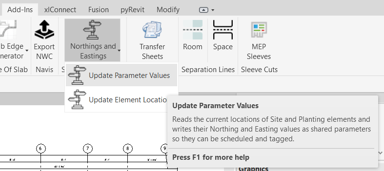
Reads each element's real-world location using the project survey point and writes Northing & Easting as schedulable shared parameters.
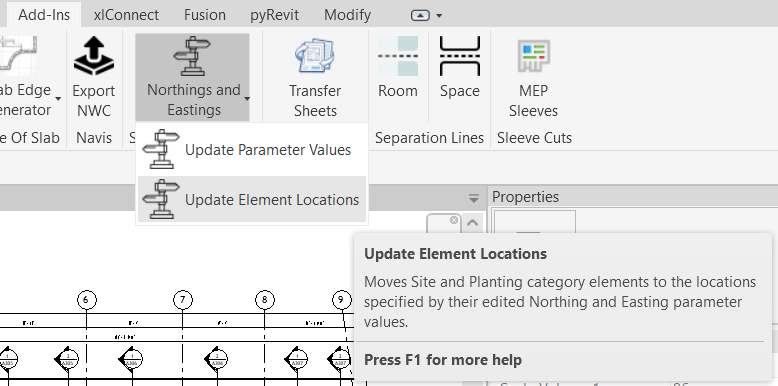
Edit a coordinate value in a schedule or properties panel — then run one command to physically move that element to its new position.
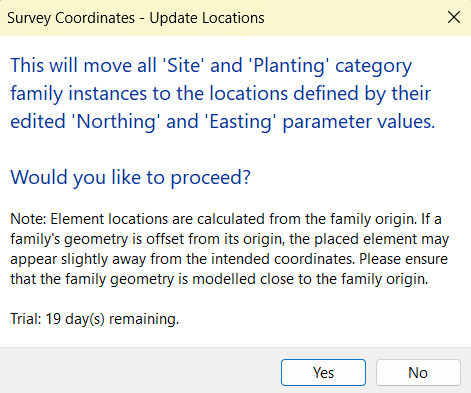
Only elements whose coordinates have actually been edited get moved. Unchanged elements are skipped, preventing accidental mass-repositioning.
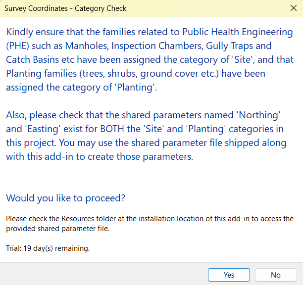
Works across both Revit categories — PHE assets (manholes, gullies, inspection chambers) and landscape elements (trees, shrubs, ground cover).
Coordinates are expressed in the project's active length unit — metres, feet, or millimetres — with no manual conversion required.
After relocating, moved elements are automatically selected and highlighted in the view so you can immediately verify their new positions.
A simple, repeatable process that fits naturally into your existing Revit workflow.
Add the provided "Northing" and "Easting" shared parameters to the Site and Planting categories in your project template.
Run Update Parameter Values. The add-in reads every element's position and writes its survey coordinates instantly.
Edit a Northing or Easting value in any Revit schedule or properties panel, then run Update Element Locations to move it.
Two focused commands — one to capture coordinates, one to move elements to match.
Start with a full-featured 30-day trial — no credit card, no email required. Upgrade to a permanent license whenever you like.
30 days · No credit card needed
One user · Revit 2025 & 2026